Services > Fields of Application
Bathymetric Survey by USV Drone
- Creation of bathymetric charts
- 3D modeling of seabed and shoreline
- Identification of logjam and wrecks
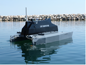
Bathymetric Survey by USV Drone – Our Expertise
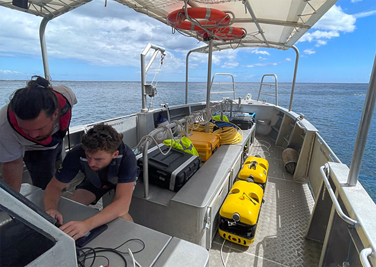
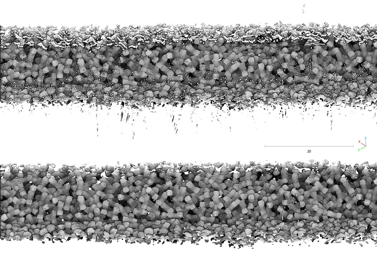
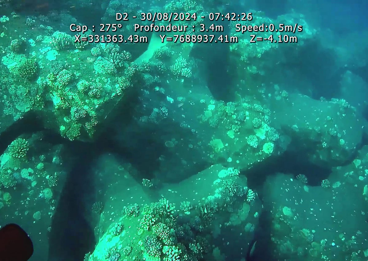
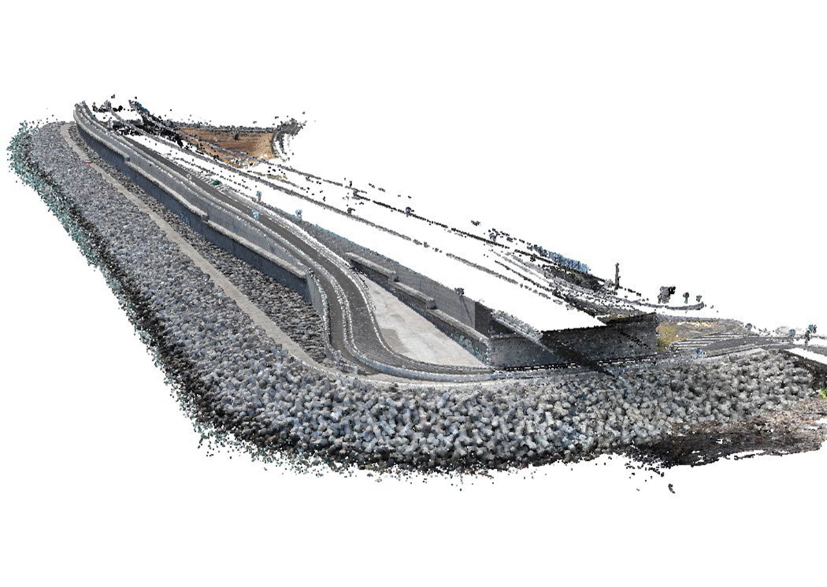
Survey of the dikes of the Nouvelle Route du Littoral
Région Réunion – La Réunion – 2024 & 2025
As part of the monitoring of coastal protection structures, Subsea Tech carried out bathymetric surveys to generate a 3D model of the dikes of the Nouvelle Route du Littoral. The operation involved a NORBIT multibeam sonar, a Mini TORTUGA ROV and a SeaTrac USBL positioning system, enabling an accurate reconstruction of the dikes’ geometry and the monitoring of their condition over time.
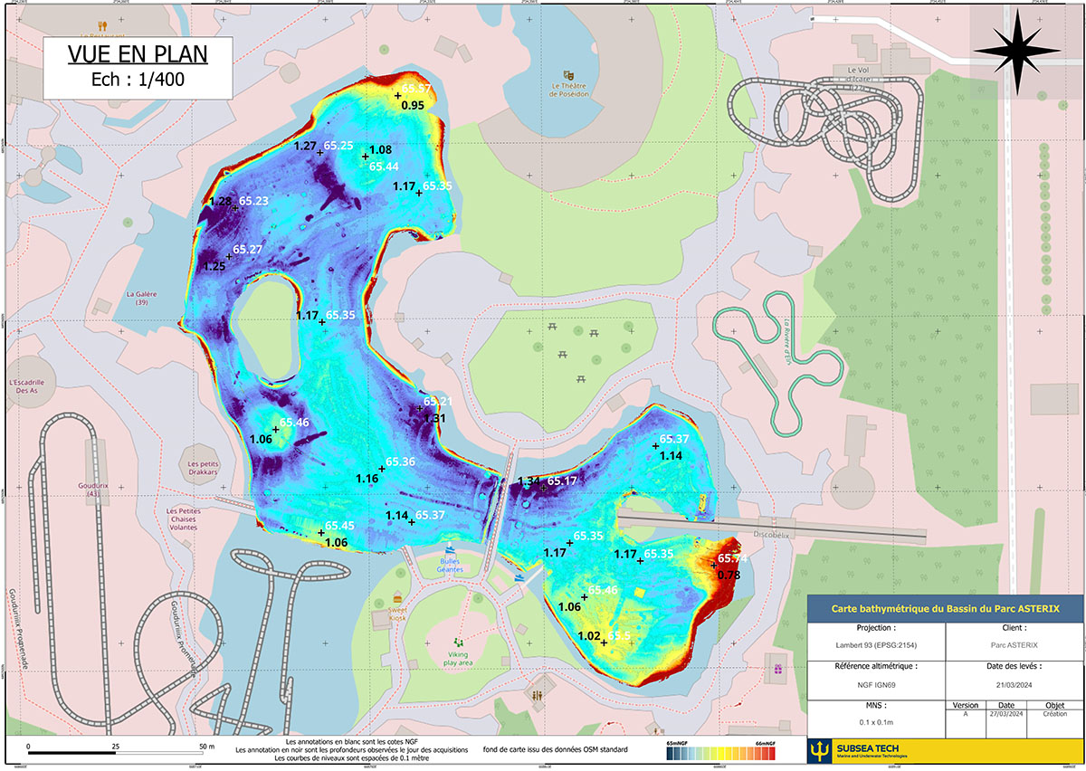
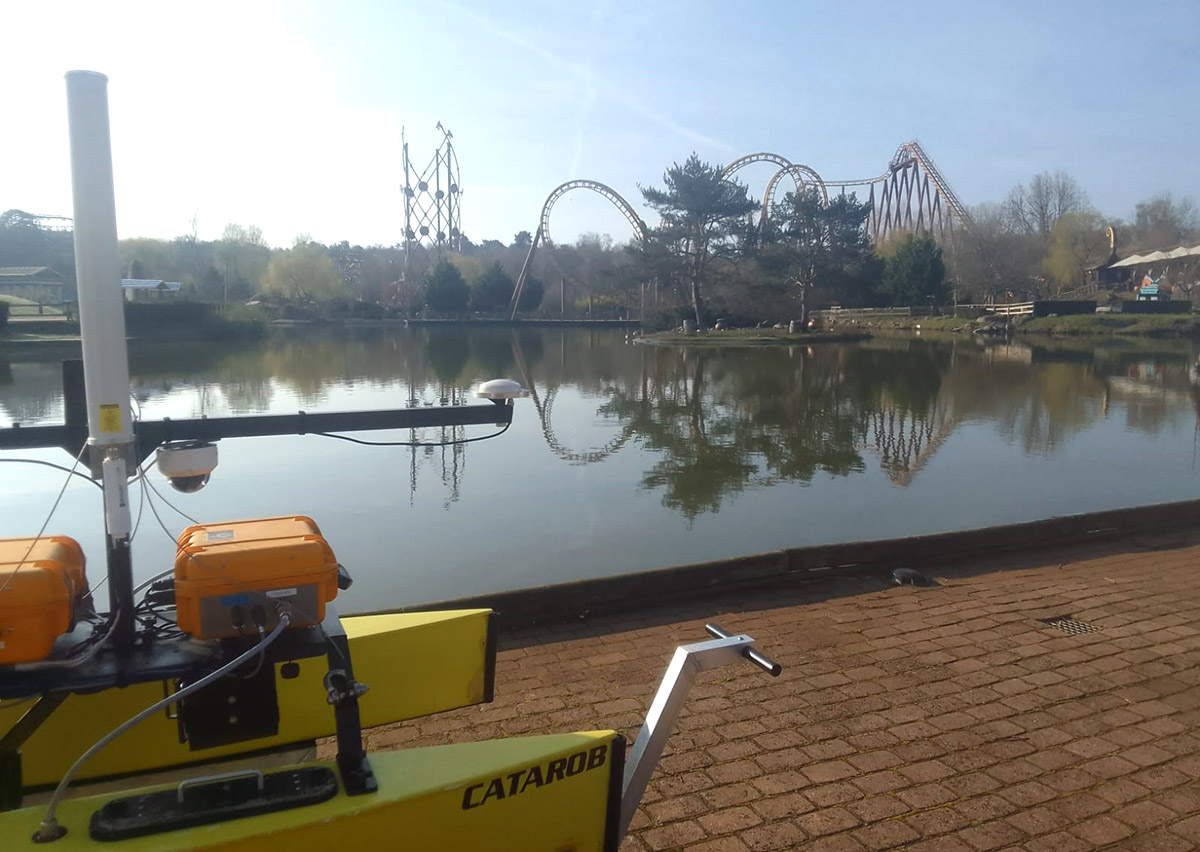
Bathymetry of a pond at Parc Astérix
Parc Astérix – Plailly (60) – 2024
Subsea Tech carried out a bathymetric survey of a pond at Parc Astérix to enable the accurate positioning of cofferdam booms in specific areas. The mission was conducted using a Catarob USV equipped with a NORBIT multibeam sonar, providing full coverage and high-precision data.
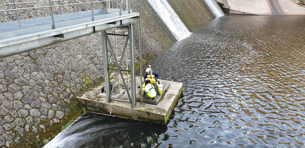
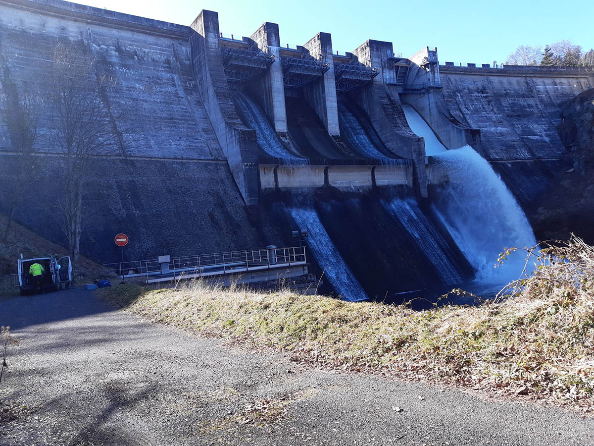
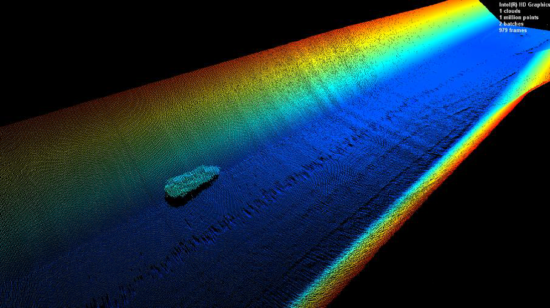
Upstream and downstream bathymetric surveys – Lavalette dam
FUGRO - Lapte (43) - 2021
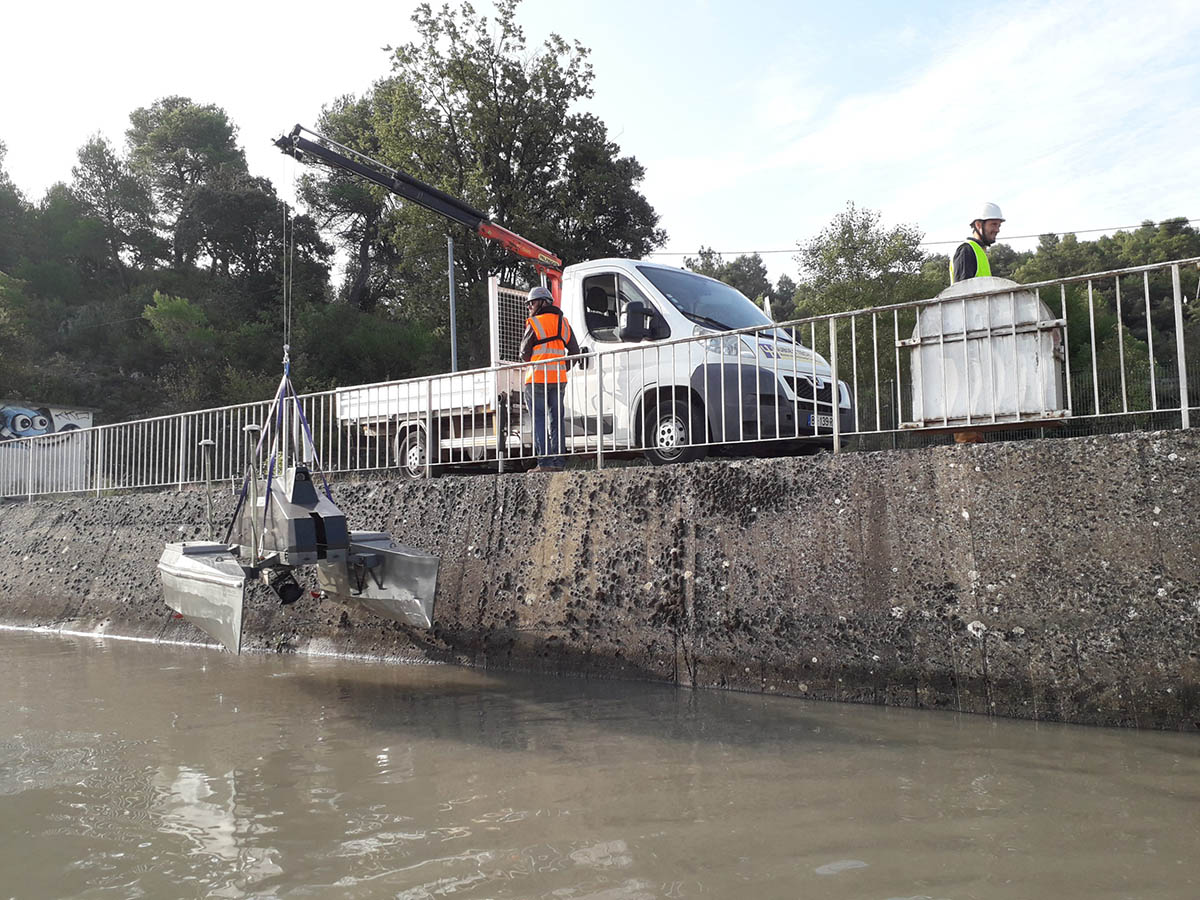
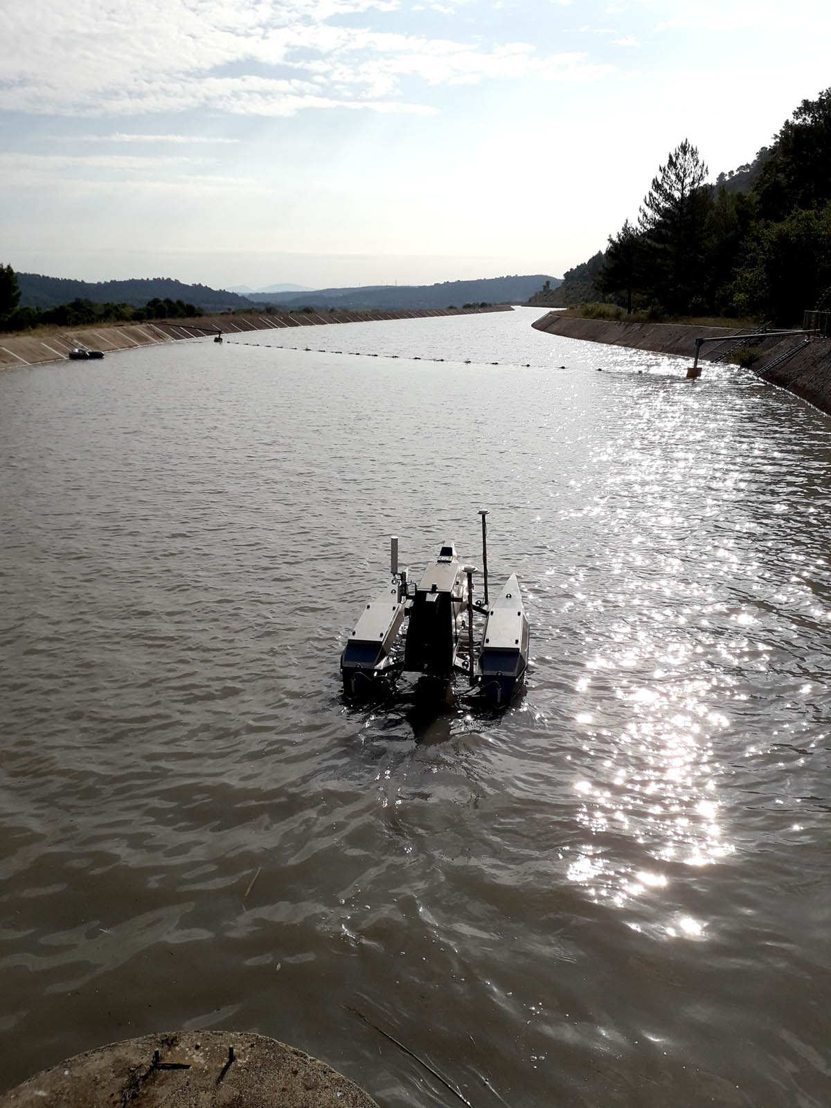
The company FUGRO subcontracted to Subsea Tech the realization of the multibeam bathymetry at the Lavalette dam in Haute-Loire county, as for a contract awarded by Saint-Etienne Métropole. The two inspected basins represented a total area of about 53 hectares (45 ha upstream and 8 ha downstream). For this mission, our Catarob USV was equipped with a NORBIT WBMS multibeam echosounder coupled with a sound velocity sensor and a NovAtel STIM-300 INS to correct the catamaran’s movements in heading, pitch, roll and heave. The whole system has a centimetric RTK positioning thanks to a GPS reference correction sent by the online geolocation network.
If the launching and the recovery of the drone upstream of the dam did not present any particular difficulty because of the presence of a nautical base with a slipway, the operations downstream required the dismantling of the various elements of the Catarob and their reassembly at the level of the only access to the water. The design of the Catarob allows for ultra-fast disassembly of the deck and hulls, which can then be easily transported separately and reassembled by a single person.
The ease of use of the Catarob and the large aperture (up to 179°) offered by the NORBIT echosounder made it possible to complete the acquisitions in a single day.
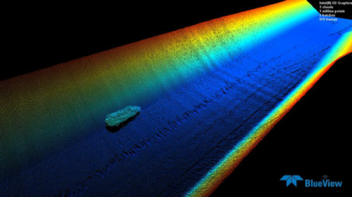
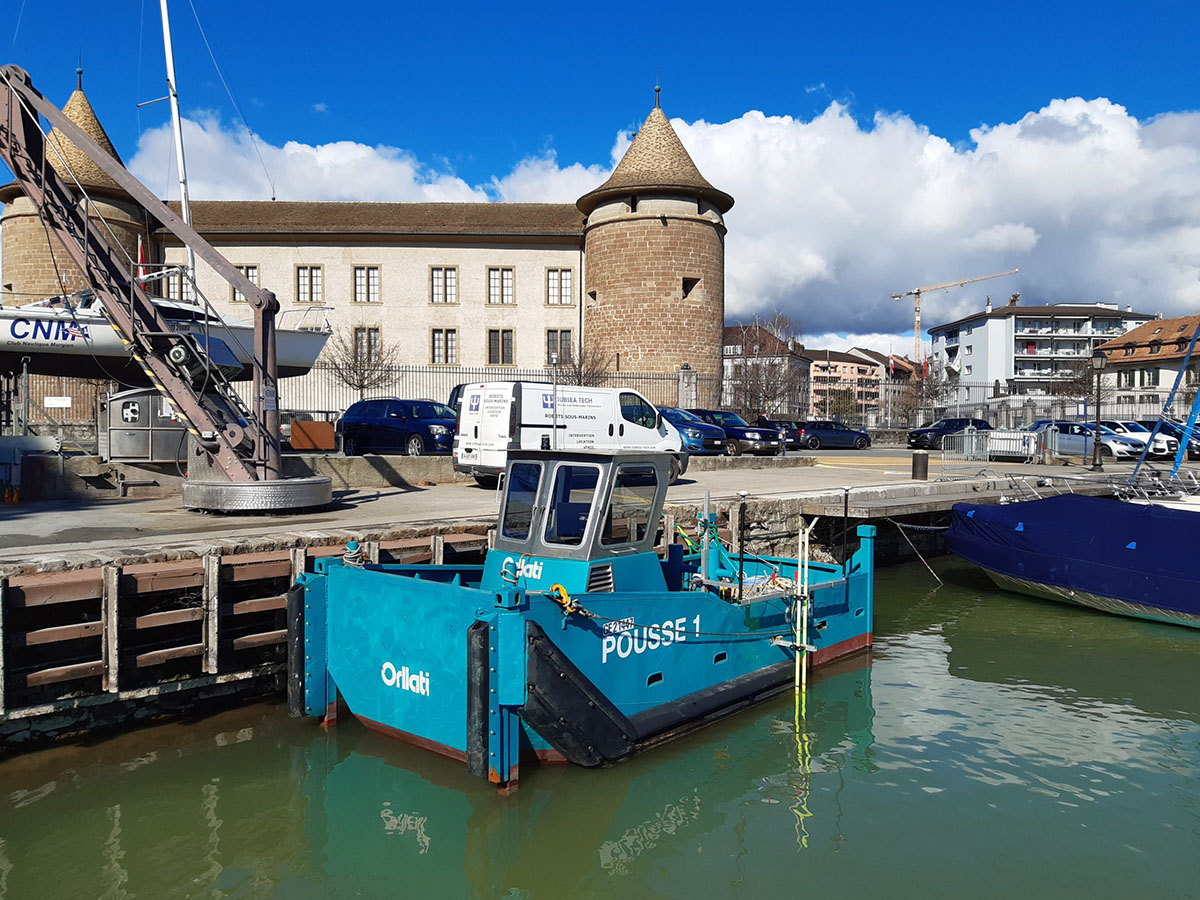
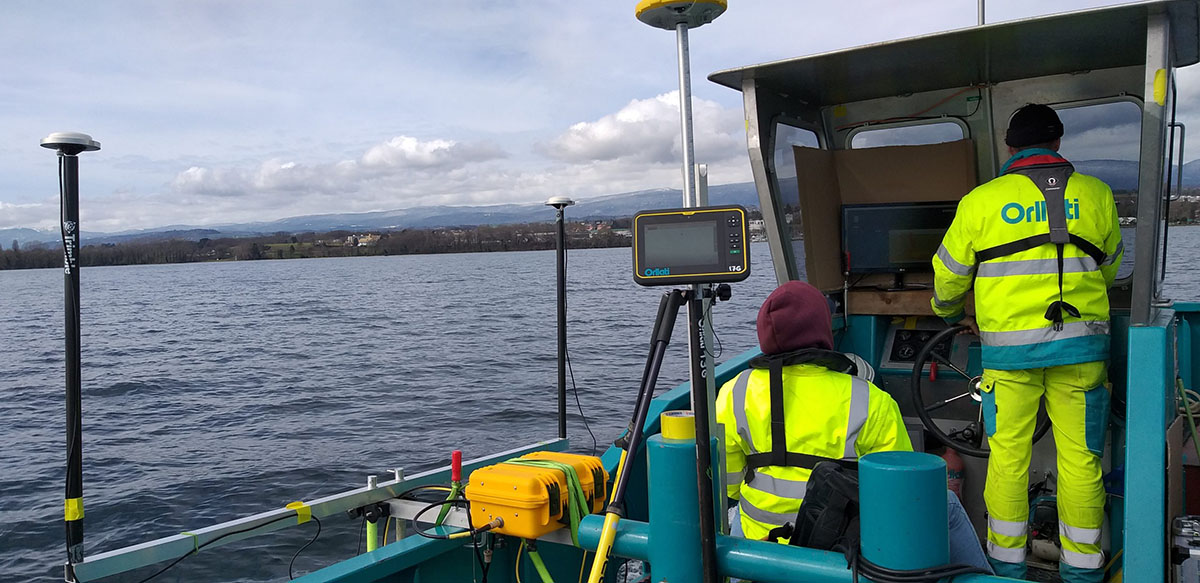
Multibeam bathymetry survey on the Lake of Geneva
ORLLATI - Morges, Switzerland - 2020
Within the framework of a water pumping pipeline installation project (for the construction of a heat pump) in Morges, the Swiss company ORLLATI entrusted Subsea Tech with the realization of a pre-construction multibeam bathymetry survey. In addition to the fine depth measurement, this survey also aimed at identifying and positioning very precisely the possible obstacles as well as the structures already installed on the area, in particular an optical fibre and two gas pipelines. The bathymetry was carried out over a distance of about 1km from the shore and over a strip of about 50m wide.
The bathymetry was performed with our Norbit WBMS multibeam echosounder, offering the advantage of high resolution and an opening angle of up to 150° to minimize the number of swaths. The sounder was deployed from the client’s vessel and was coupled to a sound velocity sensor and a NovAtel STIM-300 INS to correct the vessel’s motion in heading, pitch, roll and heave. The whole system benefited from an RTK type centimetric positioning thanks to a GPS reference correction sent by the Swiss network of online geolocation GNSS Continuously Operating Reference Station of Geneva.

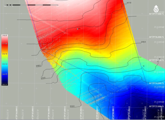
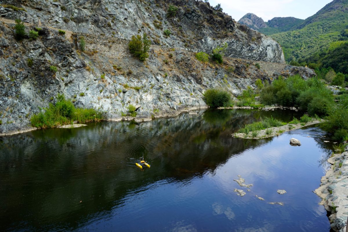
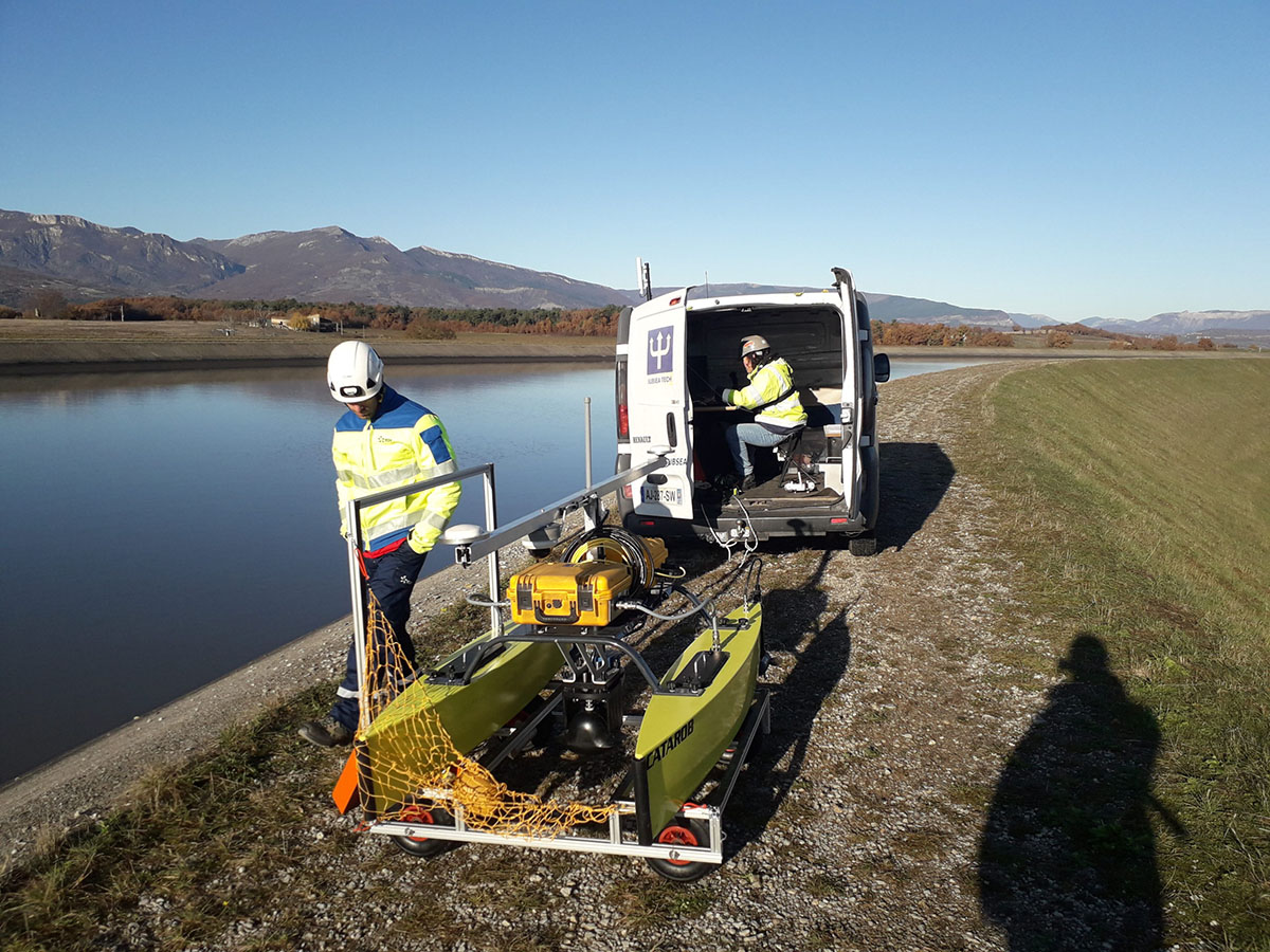
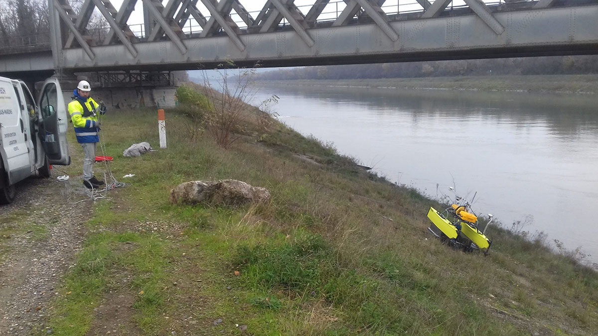
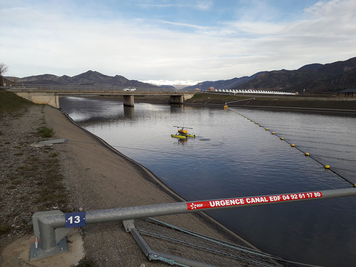
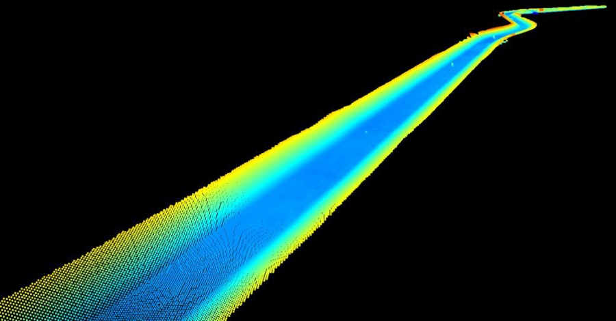
Multibeam bathymetry surveys on the Canal of Sisteron
EDF - Sisteron (04) - 2019/2020
Subsea Tech was entrusted in 2019 and 2020 to carry out 2 multibeam bathymetry campaigns by USV on a 21km long line of the Canal of Sisteron in order to identify and locate submerged obstacles that could hinder the geophysical inspections planned in 2021. The NORBIT WBMS multibeam bathymetry system was implemented by our compact and lightweight Catarob USV, which can be deployed without lifting equipment. The main constraint was the presence of several bridges on the canal with an air draft too shallow for the passage of the Catarob, and involving the recovery of the USV upstream and its relaunch downstream of each bridge. These launching/recovery operations were eased by the use of a cart and a winch, specially designed for this mission, connected to the van serving as a control station. The control van moved along the riverbank, mainly on the right bank, at the pace of the drone, i.e. at a speed of approximately 5 km/h.
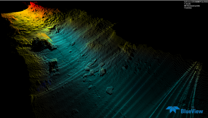
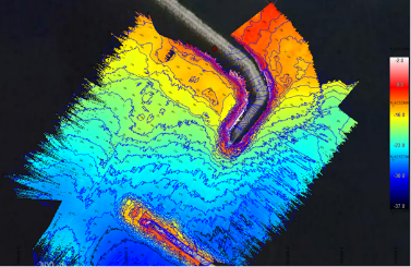
Bathymetry and 3D surveys on the Durance canal
EDF - Jouques (13) - 2018
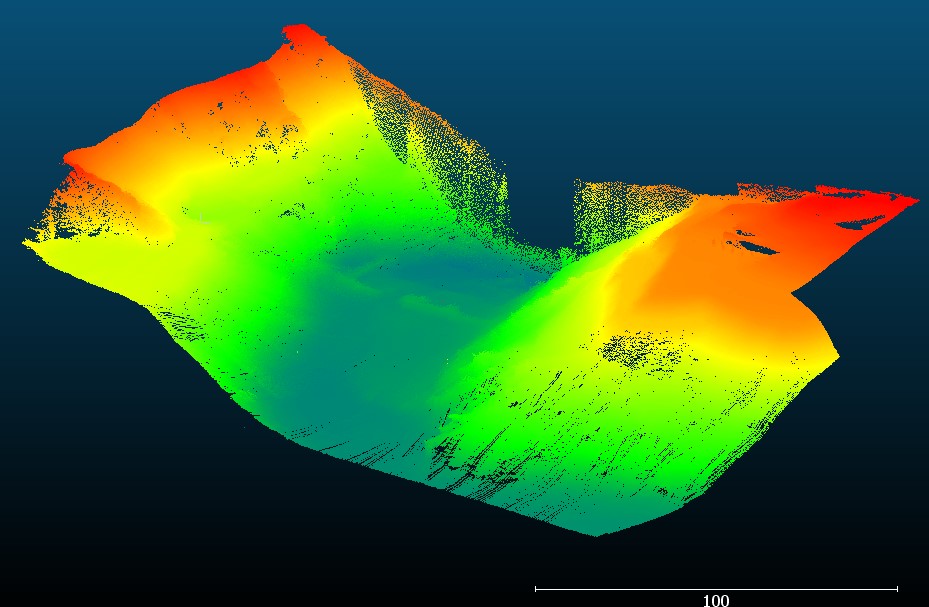
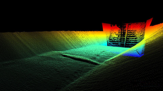
An exploration mission on the canal of Jouques was carried out in 2018 for EDF, including among others the realization of multibeam bathymetry surveys to assess the silting level and to implement the 3D modeling of the submerged part of the canal with the aim of identifying and locating possible logjams. The operation was also completed by a 3D modeling of the inlet grids of the hydropower plant of Jouques.
For this project, Subsea Tech deployed its CAT-Surveyor USV, equipped with the Seabed multibeam bathymetry system using the Norbit WBMS sounder. The high resolution sounder combined with the centimeter accuracy of the RTK DGPS integrated on the CAT-Surveyor allowed to obtain a precise estimation of the channel silting levels and to determine the nature and the exact position of some obstacles representing a risk for the installations. Thanks to the use of a surface drone powerful enough to operate in the canal current, the operation was carried out in only 2 days and in complete safety for the personnel.
The 3D modeling of the inlet screens was carried out using a Blueview 5000 3D multibeam sonar, deployed at various points on a tripod from the surface.
Some other references…
- BOSKALIS – Lubmin (Germany): Multibeam bathymetry surveys for dredging control on cable landing site
- SURVEY GROUP – Albi (81): Multibeam bathymetry and LIDAR surveys of the Tarn and its banks in Albi
- SNCF (Altametris) – Montdragon (84): Multibeam bathymetry by USV of the Rhone canal at the level of the Donzère railway bridge
- EDF – Cadarache (13): Multibeam bathymetry of the Cadarache lock basin
- CREOCEAN – Porquerolles (83): Multibeam bathymetry and side scan sonar survey off Porquerolles island
- HUBBLE AERIAL DATA – Ghisoni (2B): Bathymetry survey of Trevadine dam
- SNCF – Chalifert (77): Multibeam bathymetry survey of the Chalifert bridge
And more than 15 other references for public and private clients
Got a bathymetric survey project? Contactez-nous